Article and photos by Dee Harris
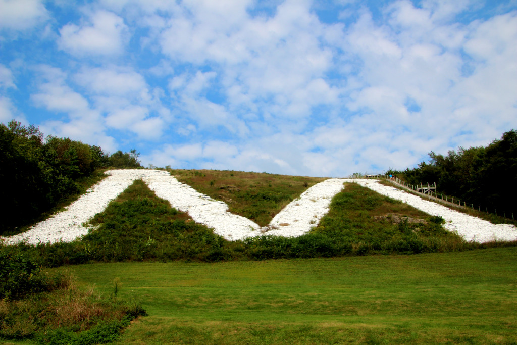
The world’s largest M is known for its 266-stair climb and miles-long view, but the majority of visitors think that’s all there is. A geocaching experience showed me there is so much more to this well-known attraction.
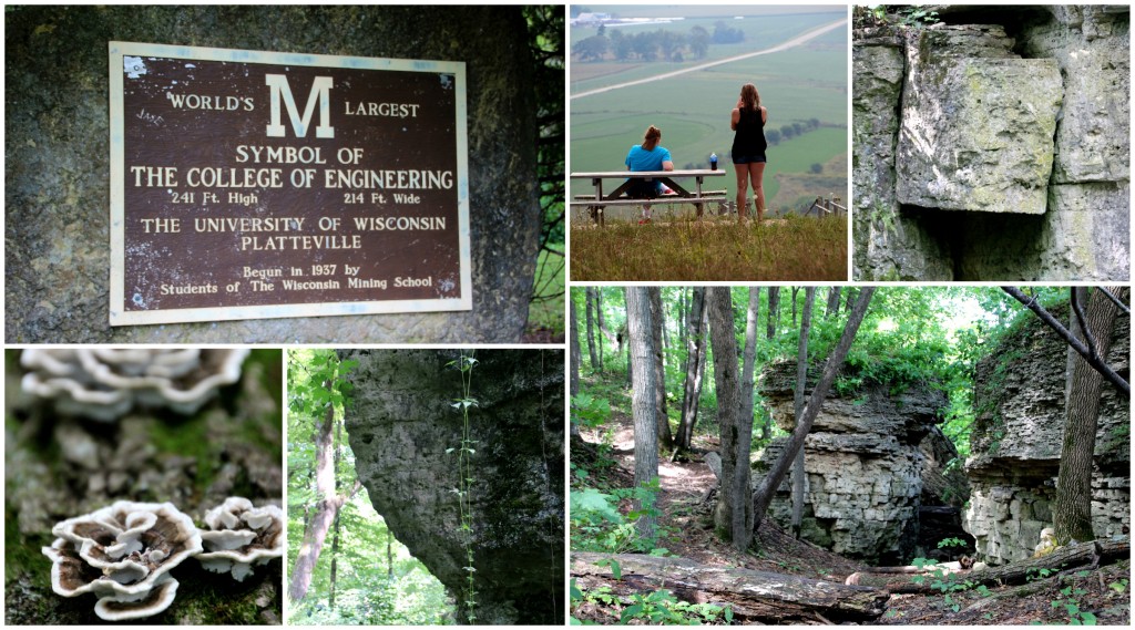
When you get to the top, stop to catch your breath, take a sip of water, then veer right to choose your own little bluff to watch the traffic below or maybe catch a glimpse of the hard-working Amish in the tobacco fields. The trail isn’t groomed, so be prepared for thorns and vines to attach themselves to you.
When you make your way back to the beginning (it’s a short loop), go the opposite direction and find the path that leads into the woods to the north of the M. At first, it’s just another dirt path that winds through the trees. But look harder.
Check out the rocks along the path. I’ve found shells embedded in some. Open your eyes to the berries, fungi and flowers growing just off the path. Listen for the overgrown forest creaking against itself and the squirrels playing in the treetops.
Just when you think you’ve seen it all, you’ll come across some small rock formations that look like they’re barely being held together. The cracks are so deep they could almost just fall apart. Go a little deeper into the woods and the rock formations get bigger, creating enormous moss-covered walls. There are plenty of opportunities for simple rock climbing. Get your hands dirty. Explore every surface. Maybe you’ll find a caterpillar like I did. Maybe a vine spinning around a flower stem. Maybe something even more of a treasure.
Eventually you’ll come across “The Hobbit Hole,” a cave that someone made into their own temporary fort. Of all of the times I’ve been up there I’ve never actually seen anyone in there, but there are always new additions to the abode. There are several small caves just off the trail that are able to be explored. I’m not much for exploring caves; they give me the creeps. But I know some people really enjoy all that goes with spelunking.
The trail gets narrower and narrower the further from the M you get. Eventually a pile of rocks (maybe a former fire pit someone assembled?) marks you’re near the end of the mound. You can go just a bit further before it leads downhill in all other directions.
When you turn around, you’ll see a whole different side of the woods on the way back. There are so many details you probably missed the first time through. Take your time and enjoy the sight.
According to the University of Wisconsin-Platteville, the M is an iconic symbol of the mining tradition that was the basis for the college. Located four miles east of Platteville, the M was first established in the snow on the hillside in 1936.
From a June 26, 2012, article at uwplatt.edu:
As history tells it, Wisconsin Mining School students Raymond “Pat” Medley ’37 and Alvin Knoerr ’37 stomped a large “M” in heavy snow on the Platte Mound in 1936. “It took several trips in parallel to widen out the path so that it would show up at a distance,” explained Knoerr in Thomas B. Lundeen’s book, “Jubilee! A History of the College of Engineering, The University of Wisconsin-Platteville, 1908-1983.”
“Shortly before sundown we walked back to Platteville and were happy to note that the ‘M’ could be discerned at a distance,” said Knoerr in the book.
The weather was particularly cold and the image of the “M” was frozen in the hillside. “This freeze contributed to the life of the snow ‘M’ and to its visibility, because a noticeable amount of dust or other material accumulated in the frozen pathway to make it more visible,” recalled Knoerr.
The following spring, a classmate of Knoerr suggested they construct a stone “M.” Another student suggested they make it the largest “M” in the country, even larger than the Colorado School of Mines’ “M,” which was 200 feet high.
The school obtained permission from landowner William Snow to construct the “M,” which is 241 feet high and 214 feet wide.
Shortly after beginning the project, H.B. Morrow, director of the Wisconsin Mining School, approved a field day for students to help construct the “M.” Students used picks, crowbars and wheelbarrows to move an estimated 400 tons of limestone to form the “M.”
The “M” was completed in the fall of 1937.
Throughout the years, the “M” has been cemented, limed and whitewashed.
The outline of the “M” is lit once each year in the fall and for special occasions, using coffee cans containing kerosene. Wicks made from sound-deadening board are lit inside more than 200 cans.
Following the Snow’s death, the 90 acres became the property of L.R. Clausen. He later donated the property to the Wisconsin State College and Institute of Technology. The Platteville Mining School became the Wisconsin Institute of Technology in 1939 and later merged with the Platteville State Teachers College in 1959 to become the Wisconsin State College and Institute of Technology at Platteville. In 1971, the name changed to the University of Wisconsin-Platteville.
The land remains under the ownership of the Board of Regents of the University of Wisconsin System, and the property was later named Clausen Park.
The Platteville Mound is one mile long and approximately one-half mile wide, 150 feet high and 450 feet above the city at the summit of the hill. The “M” was built on the south side of the hill at a 45-degree gradient.
The “M” is maintained by VECTOR, a student organization on campus consisting of representatives of organizations within the College of Engineering, Mathematics and Sciences. Maintenance includes whitewashing the “M” with lye at least once a year.


